
Drone Photography
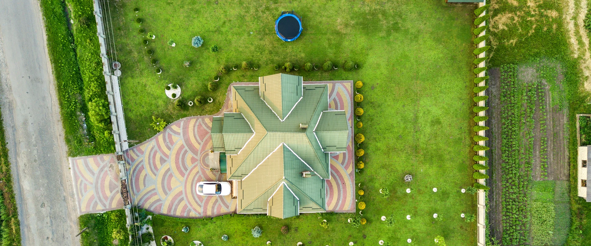
Drone Photography for Real Estate gives buyers a broader view of a property than ground-level photography alone. Professional Aerial Real Estate Photography can show the full property, lot size and layout, landscaping, backyard, pool, driveway, surrounding streets and the relationship between the property and its neighbourhood in a single perspective.
At J Light Photography Studio, Drone Photography for Real Estate complements traditional property photography by adding aerial views that help present residential, commercial and large properties from a wider perspective. Our Aerial Property Photography services are available for real estate projects in Ottawa, Montreal and Toronto, with coverage tailored to the property, its surroundings and its marketing needs.
Whether you need Real Estate Drone Photography Ottawa, Real Estate Drone Photography Montreal or Real Estate Drone Photography Toronto, aerial imagery can add valuable visual context to property listings and marketing materials while showcasing features that ground-level photographs cannot fully capture.
Professional Real Estate Drone Photography
Professional Real Estate Drone Photography complements traditional ground-level photography by giving potential buyers a broader view of the property and its surroundings. While interior and exterior photography captures architectural details and living spaces, aerial images provide visual context that helps viewers understand the property’s scale, layout and location. Depending on the property and project requirements, drone photography can highlight the following features:
Capture the entire property from above to provide a clear overview of the building, lot and surrounding area.
Showcase the exterior architecture, building footprint and overall appearance from perspectives that ground-level photography cannot provide.
Give viewers a better understanding of the property’s lot dimensions, layout and relationship between the building and outdoor areas.
Highlight backyards, patios, decks, gardens and other outdoor living areas from an elevated perspective.
Showcase landscaping, gardens, trees and other designed outdoor features across the property.
Present swimming pools, sports areas, outdoor entertainment spaces and other amenities within the broader property layout.
Provide an elevated view of the roofline and overall structure, particularly for properties where the roof design contributes to the architectural character.
Show how the property connects to nearby homes, streets and the wider neighbourhood.
Highlight driveways, entrances, nearby roads and access routes to provide additional location context.
Showcase nearby parks, waterfront areas, green spaces and other natural features that contribute to the property’s surroundings.
What Does Real Estate Drone Photography Show?
Real Estate Drone Photography provides a broader perspective of a property and its surroundings, helping potential buyers understand features that may be difficult to capture from ground level. From the property layout and outdoor spaces to nearby roads and natural features, Aerial Property Photography adds useful visual context to real estate listings and marketing materials.
Property & Lot
Aerial photography can capture the entire building and lot within a single frame, making it easier to understand the property’s overall scale and layout. This perspective works particularly well for homes with large lots, extensive outdoor areas or distinctive property boundaries.
Landscaping & Outdoor Features
Drone images can showcase backyards, gardens, pools, driveways, patios and other outdoor features from above. An elevated perspective also helps viewers see how these elements connect across the property.
Property Surroundings
Aerial Real Estate Photography can show how a property relates to its surrounding neighbourhood, including nearby streets, parks, green spaces, waterfront areas and neighbouring buildings. This additional context gives potential buyers a clearer visual understanding of the property’s setting.
Location & Accessibility
Aerial views can highlight the property’s position in relation to roads, entrances, driveways and nearby access points. This information can complement traditional property photography by giving viewers a better sense of the property’s location and connectivity.
Large Properties & Development Sites
Drone Photography for Real Estate is particularly useful for large estates, vacant land and development sites where ground-level photographs may not communicate the full scale of the property. Aerial images can present the available land, existing structures, surrounding area and overall site layout in a single visual perspective.
Why Use Drone Photography for Real Estate?
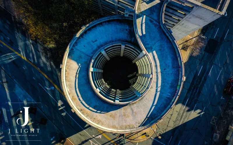
Drone photography adds a visual dimension that traditional ground-level images cannot always provide. By capturing the property from above, Real Estate Drone Photography can communicate scale, surroundings and location more clearly while giving agents, sellers and developers more versatile imagery for property marketing.
Show the Property From a Wider Perspective
Aerial photography presents the property, building, lot and outdoor areas within a broader frame. This perspective helps viewers understand the overall scale and layout of a property without relying only on multiple ground-level photographs.
Give Buyers More Context About the Location
Aerial Real Estate Photography can show the relationship between a property and its surrounding streets, neighbourhood, green spaces, parks or waterfront areas. This additional context gives potential buyers a clearer visual understanding of the property’s setting.
Highlight Large Lots and Outdoor Spaces
Drone photography makes it easier to showcase large yards, extensive landscaping, pools, gardens, driveways and other outdoor spaces. An elevated perspective can also show how these features connect with the main property.
Showcase Luxury Homes and Unique Properties
Luxury homes and architecturally distinctive properties often have features that benefit from an aerial perspective. Aerial Property Photography can highlight expansive grounds, architectural forms, waterfront settings and other characteristics that contribute to the property’s visual appeal.
Present Land and Development Sites Clearly
For vacant land, large parcels and development projects, aerial imagery can communicate the scale and layout of a site more effectively than ground-level images alone. Drone photography can also provide useful visual context around existing structures, access points and surrounding properties.
Create More Versatile Marketing Content
Aerial images can complement traditional real estate photography across different marketing channels, including property listings, websites, social media and digital campaigns. Combining ground-level and aerial imagery gives real estate professionals a broader collection of visuals for presenting the property.
Real Estate Drone Photography Services
J Light Photography Studio offers professional Real Estate Drone Photography for residential properties, commercial buildings, land and development projects. Each aerial photography service focuses on presenting the property’s scale, exterior features, outdoor spaces and surrounding area from a clear and compelling perspective.
Aerial Real Estate Photography
Aerial Real Estate Photography provides high-quality aerial still images for property listings and real estate marketing. These images complement traditional interior photography and also exterior photography by showing the property, lot, outdoor features and surrounding area from above.
Drone Photography for Residential Properties
Residential drone photography helps present the full property and its outdoor features in a single visual perspective. It works particularly well for homes where the lot, landscaping, location or outdoor amenities contribute to the property’s overall appeal.
- Houses: Showcase the home, exterior, lot and surrounding area from an elevated perspective.
- Luxury homes: Highlight expansive grounds, distinctive architecture, landscaping and premium outdoor features.
- Condos: Present the building, surrounding grounds and its relationship to the neighbourhood.
- Estates: Capture large properties, extensive landscaping, outdoor spaces and the overall site layout.
- Waterfront properties: Show the relationship between the property, waterfront and surrounding natural landscape.
- Properties with large lots: Communicate the scale, layout and outdoor features of larger residential properties.
Commercial Real Estate Drone Photography
Commercial properties often require aerial imagery to communicate the scale of the building, site and surrounding environment. Commercial Real Estate Drone Photography can provide useful visuals for property listings, presentations and marketing campaigns.
- Office buildings: Show the building, surrounding grounds, parking areas and its position within the local area.
- Retail properties: Highlight storefronts, parking areas, entrances and the surrounding commercial environment.
- Industrial properties: Capture large buildings, lots, loading areas and access routes from above.
- Commercial complexes: Present multiple buildings, shared spaces, parking areas and the overall site layout.
- Investment properties: Provide a broader visual perspective of the property and its surrounding context for marketing purposes.
Land & Development Site Photography
Aerial imagery can make large parcels and development opportunities easier to understand by presenting the entire site in a broader view. Land & Development Site Photography can complement property marketing materials with visuals that communicate site scale, layout, access and surrounding context.
- Vacant land: Show the full parcel and its relationship to surrounding properties, roads and natural features.
- Development sites: Capture the site layout, existing structures, access points and surrounding environment.
- New developments: Showcase development projects and provide broader visual context around the site.
- Large parcels: Present the scale and overall layout of extensive parcels from an elevated perspective.
- Construction-related property marketing: Provide aerial visuals that support the presentation and marketing of construction and development projects.
let’s tell your story Together
Every great story starts with a conversation. If you’re ready to create timeless photography or cinematic videography, we’d love to hear from you.
Call us or send us an email, and let’s begin planning your next project together.
Drone Photography for Real Estate Listings
Professional aerial images can add another visual layer to a real estate listing by showing the property, lot and surrounding area from an elevated perspective. Real Estate Drone Photography can complement traditional listing photography and provide versatile visuals for different property marketing channels. Aerial property images can support real estate professionals across a range of listing and marketing platforms, including:
- MLS listings: Add aerial views that provide additional context about the property, lot and surroundings.
- REALTOR® websites: Enhance property pages with wider exterior and location-focused imagery.
- Property websites: Use aerial photography to create a more complete visual presentation of the property.
- Social media: Share engaging aerial views that showcase the property and its surroundings from a distinctive perspective.
- Digital advertising: Use aerial images as visual assets for online property marketing campaigns.
- Brochures: Include selected aerial photographs to complement ground-level property images.
- Property presentations: Use aerial visuals to present the property’s scale, layout and location during client or buyer presentations.
MLS-Ready Aerial Images
Aerial images can complement the standard photography used in a property listing by showing the full property, lot and surrounding environment. J Light Photography Studio can provide professionally captured and edited aerial imagery suitable for use alongside other real estate photographs in listing and marketing materials.
Aerial Images for Social Media & Property Marketing
Wide aerial images can create an immediate visual overview of a property while highlighting its exterior, outdoor spaces and surrounding area. These Aerial Property Photography assets can support social media content, property websites and digital marketing by giving potential buyers a different perspective of the listing.
Who Can Benefit From Real Estate Drone Photography?
Real Estate Drone Photography can support different professionals and property owners who need to present a property, site or development project from a broader perspective. Aerial imagery can complement traditional real estate photography by showing the property’s scale, outdoor features, location and surrounding environment.
Real Estate Agents & Realtors
Real estate agents and REALTORS® can use aerial images to add more context to property listings and marketing materials. Drone photography can help showcase large lots, outdoor amenities, neighbourhood surroundings and distinctive property features.
Property Owners & Sellers
Property owners and sellers can use Aerial Property Photography to present their homes or properties from a wider perspective. This approach can be particularly useful for properties with large yards, attractive landscaping, waterfront views or notable surrounding features.
Real Estate Developers
Developers can use aerial photography to present development sites, large parcels and new projects in relation to their surrounding area. Aerial images can communicate site scale, access points, existing structures and the broader development context.
Commercial Property Professionals
Commercial brokers, property managers and other commercial real estate professionals can use Commercial Real Estate Drone Photography to showcase buildings, parking areas, access routes, commercial complexes and surrounding properties.
Builders & New Development Projects
Builders and development teams can use drone photography to document construction progress or create marketing imagery for new developments. Aerial views can present the relationship between buildings, outdoor areas, roads and the overall project site.
Land Sellers
Land sellers can benefit from Drone Photography for Real Estate when ground-level images cannot fully communicate the size and layout of a parcel. Aerial images can provide a broader view of the land, surrounding properties, roads, natural features and potential development context.
Drone Photography for Different Property Types
Different properties require different visual perspectives to communicate their most important features. Real Estate Drone Photography can adapt to the property’s size, architecture, outdoor spaces and surroundings, making aerial imagery useful across a wide range of residential and commercial projects.
Luxury Homes
Aerial Property Photography can showcase the architecture, expansive grounds, landscaping, pools and other distinctive features of luxury homes. Elevated views also help present the property’s relationship with its surrounding neighbourhood or natural landscape.
Residential Properties
Drone photography can provide a broader view of houses, exterior spaces, yards, driveways and surrounding streets. These images complement traditional interior and exterior photography by adding location and property context.
Commercial Properties
Commercial Real Estate Drone Photography can showcase office buildings, retail properties, industrial facilities, parking areas and commercial complexes. Aerial views can also communicate how a commercial property connects to nearby roads and surrounding businesses.
Large Estates & Properties With Large Lots
Large properties often benefit from aerial views that capture the building and extensive grounds in a single perspective. Drone photography can highlight lot layout, landscaping, outdoor amenities, access points and the overall scale of the property.
Waterfront Properties
Waterfront homes and properties can benefit from aerial images that show the relationship between the building, waterfront, shoreline and surrounding landscape. This perspective can provide visual context that ground-level photography may not fully capture.
New Developments
Drone photography can showcase new residential or commercial developments from a broader perspective. Aerial images can present buildings, roads, shared outdoor spaces and the overall development layout while also supporting project marketing.
Land & Development Sites
Land & Development Site Photography provides an effective way to communicate the scale and layout of vacant land, large parcels and development opportunities. Aerial images can show site boundaries, access routes, surrounding properties and nearby natural or built features.
Explore Our Real Estate Drone Photography Portfolio
See how professional aerial photography can showcase properties from a wider perspective. Our Real Estate Drone Photography portfolio features examples of aerial property views that highlight architecture, lot size, outdoor spaces, landscaping and the surrounding environment. Browse our portfolio to explore the quality and visual style of J Light Photography Studio and see how aerial imagery can complement traditional real estate photography.
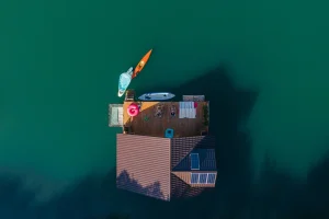
Real Estate Drone Photography in Ottawa
J Light Photography Studio provides professional Drone Photography Ottawa services for residential and real estate properties that benefit from an elevated perspective. Real Estate Drone Photography Ottawa can showcase large residential lots, outdoor spaces, estates, landscaping and the surrounding landscape while providing useful neighbourhood context. Our Aerial Real Estate Photography Ottawa gives potential buyers a broader view of the property, its layout and its relationship with nearby streets and natural features. For agents, sellers and property professionals, Property Drone Photography Ottawa can complement traditional real estate images with wider and more informative aerial views.
Real Estate Drone Photography in Montreal
Professional Drone Photography Montreal can add valuable aerial perspectives to residential, commercial and development properties. Real Estate Drone Photography Montreal can highlight property exteriors, large lots, outdoor spaces and surrounding neighbourhoods, while Aerial Real Estate Photography Montreal can provide broader context for properties with distinctive architecture or extensive grounds. J Light Photography Studio also provides Property Drone Photography Montreal for commercial properties, architectural projects and development sites where an elevated perspective can help communicate the scale and setting of the property.
Real Estate Drone Photography in Toronto
Drone Photography Toronto provides a broader way to showcase luxury homes, large properties, commercial real estate and development sites. With Real Estate Drone Photography Toronto, aerial images can highlight lot size, rooflines, pools, outdoor spaces, surrounding streets and neighbourhood context while presenting the property’s overall setting. Aerial Real Estate Photography Toronto can also support the marketing of land and development projects by showing the relationship between the site, surrounding properties and nearby infrastructure. For properties throughout the Greater Toronto Area, Property Drone Photography Toronto and Drone Photography GTA can complement traditional real estate photography with professional aerial perspectives.
Our Real Estate Drone Photography Process
A professional aerial photography session requires more than capturing images from above. At J Light Photography Studio, the process focuses on understanding the property, planning the aerial shoot and producing polished images that clearly present the property and its surroundings.
1. Property & Project Assessment
We review the property and project requirements to determine which features will benefit most from an aerial perspective. Property size, architecture, outdoor spaces, surrounding landscape and the intended use of the images help shape the photography approach.
2. Flight Planning
We plan the aerial session according to the property, location and project requirements. This stage helps determine suitable perspectives and compositions for capturing the building, lot, outdoor features and surrounding area.
3. Aerial Photography
We capture a range of aerial perspectives designed to present the property clearly and highlight its most relevant features. Depending on the project, images can focus on the property exterior, lot layout, landscaping, outdoor amenities and surrounding neighbourhood.
4. Image Selection & Professional Editing
After the session, we select the strongest images that communicate the property’s features and overall setting. We then apply professional editing to create clean, balanced and polished aerial photographs suitable for real estate marketing.
5. Final Image Delivery
The final aerial images are prepared and delivered for use across the agreed marketing channels. These can complement traditional real estate photography and support property listings, websites, social media and other marketing materials.
Drone Photography Pricing for Real Estate
The cost of Real Estate Drone Photography can vary from one property and project to another, so a single fixed price may not reflect the requirements of every aerial photography session. Factors such as the property itself, location, scope of the shoot and final deliverables can all affect the overall cost. The main factors that can influence real estate drone photography pricing include:
- Property size: Larger properties may require more aerial perspectives to present the building, lot and surrounding areas effectively.
- Property type: Residential homes, luxury estates, commercial properties, land and development sites can have different photography requirements.
- Location: The property’s location can affect the planning and requirements of the aerial session.
- Travel requirements: Projects outside the standard service area may involve additional travel considerations depending on the location.
- Number of aerial images: The number of final images required can influence the scope of the photography and editing work.
- Photo vs. photo + video: Aerial photography alone has different production requirements from a project that also includes drone video.
- Flight requirements: The property’s characteristics and the planned aerial perspectives can affect the requirements of the flight session.
- Editing requirements: More extensive image selection, retouching or post-production can affect the overall project scope.
- Project complexity: Properties with large sites, multiple structures, distinctive surroundings or specific marketing requirements may require a more customized approach.
What Makes Aerial Photography Valuable for Property Marketing?
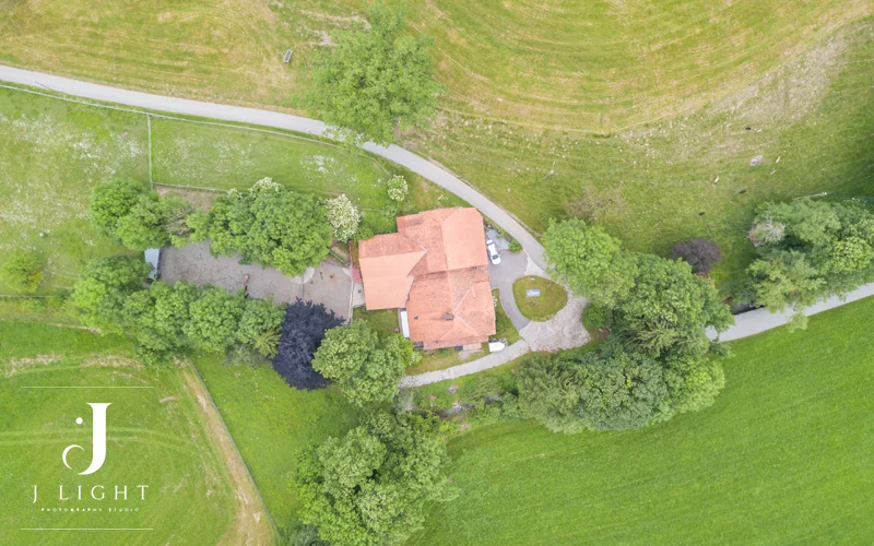
Aerial photography adds a visual storytelling element to property marketing by showing more than the building itself. Instead of focusing only on individual rooms or exterior details, Aerial Real Estate Photography can communicate how the property fits within its lot, neighbourhood and surrounding environment. This broader perspective can make property marketing materials more informative and visually complete.
- Showing Scale: Aerial images can show the size of the property, building and surrounding grounds within a single perspective.
- Showing Context: Images can illustrate how the property relates to neighbouring buildings, streets, green spaces and other surrounding features.
- Showing Location: Elevated views can provide additional visual context about the property’s position and accessibility within the surrounding area.
- Showing Outdoor Features: Pools, gardens, patios, landscaping, driveways and other outdoor amenities can be presented as part of the overall property.
- Creating a Stronger Property Presentation: Combining aerial views with interior and ground-level exterior photography creates a more comprehensive visual story of the property.
- Supporting Listing and Marketing Materials: Aerial images can provide versatile visual assets for MLS listings, property websites, social media, brochures and digital marketing campaigns.
Drone Photography Regulations in Canada
Drone operations for real estate photography in Canada must follow the applicable requirements of Transport Canada and the Canadian Aviation Regulations. The rules can vary depending on the drone, type of operation, airspace and project location, so flight requirements should be reviewed before each session.
At J Light Photography Studio, aerial photography projects should be planned with the property’s location and applicable airspace requirements in mind. For the latest information on drone operations, flight restrictions and regulatory requirements in Canada, refer to the official Transport Canada drone safety and regulations guidance.
Why Choose J Light for Real Estate Drone Photography?
Choosing the right aerial photography team can make a difference in how clearly a property is presented. J Light Photography Studio combines aerial perspectives with professional real estate photography to create imagery that showcases the property, its outdoor features and its surrounding environment.
Our approach focuses on the visual requirements of property marketing, from residential homes and luxury estates to commercial properties and development sites.
Drone photography complements traditional interior and exterior photography, providing a more complete visual presentation of the property.
We focus on perspectives that communicate important features such as lot size, architecture, landscaping, outdoor spaces and surrounding areas.
Selected aerial photographs receive professional post-production to create polished and consistent visual assets for property marketing.
We provide real estate photography services in Ottawa, Montreal and Toronto, supporting properties across these key markets.
Aerial images can complement MLS listings, property websites, social media, brochures and other real estate marketing materials.
FAQs
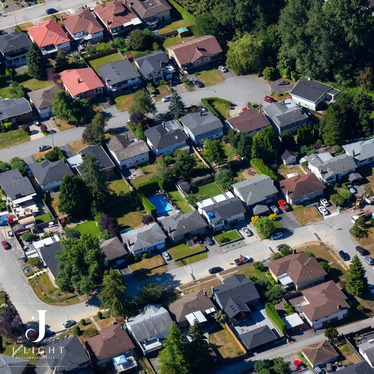
Yes. J Light Photography Studio offers drone photography for commercial properties, including office buildings, retail properties, industrial facilities and commercial complexes. Aerial images can showcase the building, property grounds, parking areas, access points and surrounding environment.
Yes. Drone photography can complement interior and ground-level exterior photography to create a more complete visual presentation of a property. This combination can showcase both architectural details and the property’s broader setting.
The session time depends on the property’s size, location, project requirements and number of aerial perspectives needed. Smaller residential properties may require less time, while large estates, commercial properties and development sites can require a longer session.
The cost depends on factors such as property size, property type, location, travel requirements, number of aerial images, flight requirements and editing scope. Projects that include both aerial photography and video may have different pricing.
Make sure the property and outdoor areas are ready for photography before the session. Clearing unnecessary vehicles or objects from key areas, preparing landscaping and ensuring important exterior features are accessible can help create cleaner and more effective aerial images.
There is no fixed number that suits every property. The ideal number depends on the property’s size, layout, outdoor features and the amount of context needed to present it effectively. A smaller property may need fewer aerial views, while a large estate or development site may benefit from a broader selection.
Yes. Aerial photography projects can include still images, video or both, depending on the project’s requirements. Combining aerial photos and video can provide versatile visual content for property listings, websites, social media and other marketing channels.
Clear and stable weather generally provides better conditions for aerial photography. Strong winds, rain, snow, poor visibility and other challenging weather conditions can affect flight conditions and image quality, so the session may need to be adjusted when conditions are unsuitable.
How to Prepare for a Real Estate Drone Photography Session?
Proper preparation can help create cleaner aerial photos and videos and make the drone session more efficient. Before the photographer arrives, preparing the property, outdoor areas and surrounding spaces can help ensure that important features appear clearly in the final visuals.
Prepare the Property Exterior
Make sure the exterior of the property looks clean and presentable before the drone session. Clean windows, organize outdoor furniture, remove unnecessary objects and prepare visible areas such as patios, decks, gardens and entrances.
Prepare the Yard and Landscaping
Well-maintained landscaping can make a significant difference in aerial property images. Mow the lawn, trim overgrown plants, remove garden debris and arrange outdoor features so the overall property looks organized from above.
Remove Unnecessary Vehicles and Objects
Move unnecessary vehicles, trailers, bins and other temporary objects away from important areas before the session. Keeping driveways, entrances, yards and key exterior spaces clear can create cleaner aerial compositions.
Prepare Pools and Outdoor Amenities
If the property has a pool, hot tub, sports area or outdoor entertainment space, prepare these areas before photography begins. Clean and organize these features so aerial images can clearly show how they fit within the overall property layout.
Keep the Property Accessible
Make sure the photographer can access the property and any relevant outdoor areas needed for the aerial session. Inform the photography team about gates, restricted areas, ongoing construction or other conditions that could affect the planned shoot.
Check for Temporary Construction or Maintenance Work
Complete or pause visible maintenance and landscaping work when possible before the session. Construction materials, equipment and temporary structures can distract from the property’s main features and affect the appearance of aerial photos and videos.
Consider the Best Time for the Shoot
The time of day can influence the lighting, shadows and overall appearance of aerial imagery. The photography team can consider the property’s orientation, surrounding environment and project requirements when determining a suitable time for the session.
Communicate Important Property Features
Let the photographer know about features that should receive particular attention before the session. Large lots, waterfront areas, unique landscaping, outdoor amenities, multiple structures and distinctive architectural elements may require specific aerial perspectives.
Be Prepared for Weather Changes
Weather conditions can affect drone photography and videography, particularly strong winds, rain, snow and poor visibility. Keep the schedule flexible when possible so the session can take place under suitable conditions for safe flight and quality imagery.